As technology advances exponentially, experts in the field of forestry have harnessed these technologies to better understand and monitor deforestation, conservation and environmental degradation. Oleg Seliverstov, Head of GIS at Aspectum, a cloud-based solution for data analytics and visualisation, shared his thoughts with Earth.Org about deforestation, environmental degradation, nature conservation, drone mapping technologies and the role of geospatial technology in forestry.
—
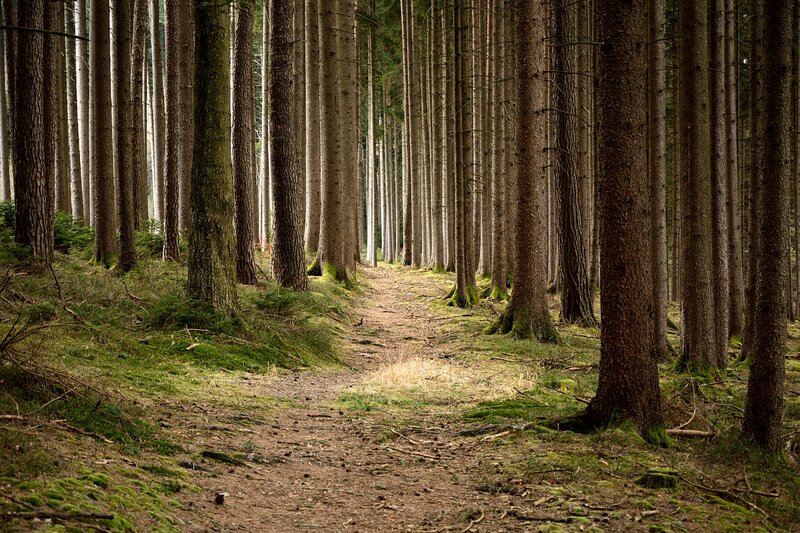
Earth.Org: One of the most critical issues facing forests in the world is alarming deforestation. In your view, how can geospatial technology address this issue in forestry?
Oleg Seliverstov: Interestingly enough, in some regions natural tree growth outstrips the deforestation rates. Forest areas are increasing as logging areas, pastures and abandoned arable lands are becoming overgrown. As a result of weather conditions and climate change, forests may be spotted even in the steppe regions.
Still, the overall statistics show that there’s a sharp decline in forest land areas on the planet. In the last 40 years, the average forest area decreased twofold from 1.2 hectares to 0.6 hectares per person.
There are different reasons behind deforestation tendencies. Obviously, the principal one is felling. We keep destroying forests for raw materials, paper production, fuel and furniture. Also, wood is cut down to free land for construction or farming.
Also, the problem is that in many cases tree felling is illegal and therefore uncontrollable. There must almost always be a license for chopping a tree down, and if it is cut without one, it’s a felony. The penalties vary depending on the crime volume and on the country. For example, in the EU the penalties range from €63.49 per tree to up to 2 years imprisonment. Despite the punishments, illegal logging costs the global market US$10 billion annually.
But it’s not only about the money. All organisms on the planet Earth are intertwined. By eradicating forests, we destroy the habitats of myriads of animals and plants, reduce biodiversity, disrupt regional water balances, and destabilise ecosystems. The latter, in turn, reduces nature’s ability to cleanse water and air from pollution and leads to an increased risk of diseases spreading.
You might also like: How Drones Can Be Used to Bolster Conservation Efforts
EO: Why is using geospatial technology in forestry important? What industry trends do you foresee?
OS: Every year forestry enterprises, just like enterprises in any other industry related to natural resources, are increasingly adopting geospatial technology to improve daily operations. The rapid progress of technology is changing the GIS used, turning it into a distributed “neural system” that analyses current situations, predicts options for future states and recommends optimal solutions.
For instance, stationary sensors allow you to more accurately track the weather, insect pests, warn of fires and other adversities. Mobile sensors of transportation vehicles, employees’ mobile devices, timber batches tags, etc. allow you to control the movement and condition of resources, as well as better coordinate field and office teams, and take prompt corrective actions. For example, a cell phone collects a rich amount of data. It has different types of sensors for detecting motion, environment and position. A cellphone has on average twelve sensors that collect data. Ideally, this data should be used for GIS intelligence and forestry as well.
Regular surveys from drones, airplanes and satellites provide farms with data on equipment conditions, warehouses, roads and forests with a level of accuracy reaching down to individual trees. In the coming years, we will be able to determine the height, trunk diameter, species and age of each tree. As for groups of trees and small areas of forests, we will be able to determine signs of damage, infection, drying out, and more.
Drones are gradually taking the stage as the market share of drone services is expanding and is predicted to reach $63.6 billion in five years.
EO: One of your points of interest is nature conservation. Can you tell us more about its importance and the input of GIS into it?
OS: Numerous studies suggest that the contemplation of nature drastically decreases stress and improves mental well-being. But sadly, each year city citizens have fewer and fewer of such opportunities.
Now the efforts of experts in the field of nature conservation are directed at the studying, monitoring and forecasting of natural processes separately and in conjunction with anthropogenic ones. Certain applied areas of nature conservation include the development of the state and business policies, development of legislation and regulatory requirements, business certification, and business and government control mechanisms. All these initiatives aim to reduce industrial and household emissions, slow down the destruction of species and their habitats, develop environmental education and introduce best practices for balanced consumption and sustainable development.
And since all these tasks have a spatial component, it is impossible to perform them efficiently without using maps, spatial models and geographic information systems.
EO: The benefits of UAV (drone) capture are higher-quality imaging and temporality. Can you expand on that and the other benefits you see in this technology?
OS: Usually, UAVs (drones) are used when for some reason data from ground sensors, aerial or space surveys is insufficient or when the work of a field specialist is impossible or ineffective.
With the help of UAV, we can quickly examine sites “on-demand” at a smaller cost than from operational satellite imagery. Moreover, we receive information on damage from poor weather, fires, landslides, etc. Thus UAV can be useful for investigating with passive sensors under the cloud cover when satellite imagery is ineffective. In addition, UAV will be useful for regular monitoring of the condition of a limited area, for example, at the level of a forest enterprise or even at the level of individual plantations of a young forest.
Furthermore, UAV is irreplaceable if we want to obtain the spatial resolution of data at the level of the upper inches of the surface, for example, to monitor the level of water rise, tree growth rate, or to investigate individual parts of the tree crown.
EO: How can different industries adopt drone mapping technology?
OS: Drones help make our maps more accurate, both spatially and temporally. In many cases, drones are already more cost-effective than field teams and are safer because they can operate in hostile environments, reducing the risk of personnel injury. If your business has been previously associated with collecting field data or performing routine mechanical operations, it’s important to closely follow current trends in the industry and cases of successful implementation.
Oleg Seliverstov is a Head of GIS at Aspectum, technological specialist, geospatial and remote sensing data analyst with more than 15 years of experience in projects related to geography, cartography and forestry.